Stick around after the photo journal for our final thoughts on how to navigate this gorgeous and untamed country.
Road map if you care to follow along.
Couple shots of daily life:
 |
| Our travel guides. TBTA is coming along for the ride. |
 |
| Not sure how effective the seatbelt is in this situation. |
Day 1 - Pancake Rocks and the Perfect seaside campground
After a surprisingly comfortable and long night of sleep just outside of Christchurch, we motored over Arthur's Pass and headed up the west coast thru Greymouth to see the Pancake Rocks. We've never seen anything like it and a bit of a mystery how they formed. No really, even the geologists aren't sure...
 |
| We've really grown to love their plain spoken warning signs and PSAs. |
We settled in for our first "freedom camp" site right along the coast highway at a lonely picnic area just steps away from the ocean. The beach had curiously perfect round rocks that made for some fun sculpture making. We also got to farm for clams with a couple local folks out for a free gourmet meal. Nicole and I had another mini date and pondered very little as the sun fell asleep.
 |
| Most roadside picnic sites can double as free lodging for RVs. |
 |
| Beach front property |
 |
| We created a mysterious landscape. Wondering how long these will last. |
Day 2 - Lake Matheson
Most of this day was spent driving the coast in and out of inlets, over small passes, and stopping in occasional towns like Hotitika for some shopping. This was also our first of several "dump" experiences.
 |
| Fresh water in... Not fresh liquid going out... |
Nearly every postcard stand in NZ has a couple glorious pictures of a vast pristine mountain lake nestled in a valley that opens up to snow capped mountains and glaciers - Lake Matheson. Oddly enough, we had no idea where it was until we rolled in to the town of Fox Glacier, and a street sign said it was 6km that way. Well ok, we're going that way! After a short walk thru a lush forest of mossy trees and ferns we came upon the lookout and all said, "huh, is that it?" The lake was decidedly smaller than we expected, the breeze distorted any reflection, and the mountains were masked in clouds. Oh well, we needed to stretch our legs. Turns out, the best view was from the country road on the way back to the main road.
 |
| Not postcard worthy |
 |
| More postcard worthy. |
We had intended to motor on to another town, but opted to stay in town to check out the glacier. We found a neat little holiday park that had glorious showers. Yay! Clean again.
Day 3 - Fox Glacier
Our first stop was to check out Fox Glacier, once a mighty river of ice that flowed in to the ocean some 20,000 years ago. It's still one of the very few glaciers that penetrates a semi tropical environment. The hike wasn't too long, but it's getting longer and longer every year as it chases the receding ice wall. Nowadays, the only real way to get a good view is by helicopter (which are zooming around like it's Apocalypse Now). Zane seemed particularly interested in the geology of the area and how the glaciers carved the mountains.
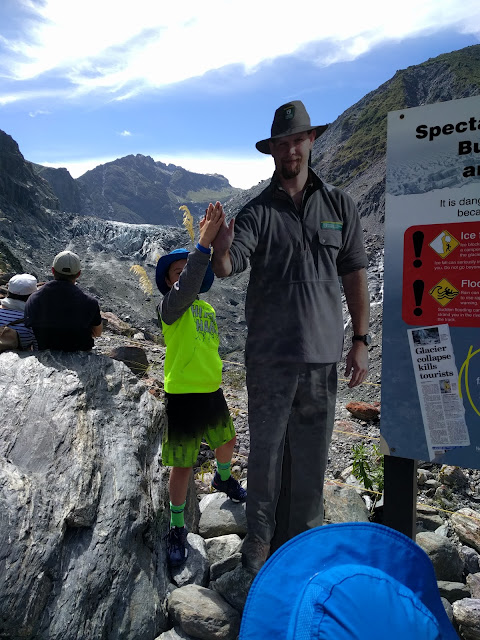 |
| Curiously thin park ranger doling out high fives at the top of the trail. |
 |
| The once mighty glacier would have been blocked by Zane's head about 20 years ago. It's going fast. |
We carried on to wonderful campground on Lake Hawea (after a brief stop at the Blue Pools), just before the town of Wanaka (emphasis on the first syllable). This happened to be the best rock skipping lake on the planet. No joke. It was as though a team of stone masons had spent the better part of a millennia hand crafting an entire beach of perfectly round and flat stones right up against a placid lake. The boys (I'm a boy too) spent several hours hucking stones in that lake.
 |
| The Blue Pool. Brave people would plunge from the bridge above. |
 |
| Paparazzi. |
 |
| Took a morning "jog" straight up the mountain above our campsite to snap this photo of Lake Hawea. Hardest one mile "run" of my life... |
 |
| Every now and then when you look up from a run, I get stopped in my tracks. There was a faint rainbow out there. |
A comment about campgrounds in New Zealand... Having spent a good many nights at campsites in the States, we were surprised that every campground we visited in nz were really just open fields like a parking lot. There weren't any official site numbers. So you just sort of drive in and park where it suits you, like under a nice Birch tree.
 |
| Not unlike our African safari, we did a fair amount of roadside stops to capture our images. Sawa, Sawa? |
 |
| Autumn playing with the camera en route. |
Day 4 - Puzzling World and Lavender Farm
The morning saw us visiting Puzzling World and getting stuck in a human maze for 45 minutes and fooling ourselves in to thinking up was down. Good times.
 |
| This huge room of following faces was a bit creepy. |
 |
| #thatwanakatree |
 |
| Any opportunity to huck a flat stone over a body of water is a good opportunity. |
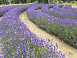
Next stop, a Lavender Farm. More than just purple flowers, it was a bit of a working farm. Nicole and Autumn we're in heaven. In fact, as we left, Autumn said it was one of her favorite places so far as it ticked all her boxes: the color purple, bees, alpacas, snorting pig, baby lambs, rolling hills, smelling flowers, taking pictures, and no crowds.
We motored on to Queenstown thru a tight little valley with a road that zig zagged over a creek flanked by multi colored lupine. I think NZ was somehow torturing us by creating a picture perfect setting, yet providing no safe haven to pull over and smell the roses, so to speak. We'll have to settle for our mental photos.
Day 5 - Jumping off a Cliff and panning for gold
Queenstown is the epicenter of adventure activities and the birthplace of the bungy jump. It's impossible not to get your adrenaline going when you are here and the massive wall of brochures in the tourist center gives you plenty of options. We (and by we, I mean Nicole and I) opted for throwing ourselves off a cliff and dropping 350ft until a rope goes taught and swings you out over a river a thousand feet below. They called it Shotover Swing. As mentioned several times in previous posts, this is precisely the fear I have, wanting to throw myself off cliffs, yet at the same time being completely petrified by this urge. Here is the video:
It was such an adrenaline overload that I was reasonably comatose for the remainder of the day. Nicole LOVED it (the jump that is, not my being comatose).
Speaking of the rest of the day, the kids wanted to try their luck at finding gold in the Shotover River in Arrowtown. Afterall, this is the richest gold river in the world after the Yukon in Canada. Arrowtown is a really cool old mining town founded on the heels of the California gold rush and feels just like you've teleported to Angel's Camp, Placerville, or Auburn. As it turns out, our nascent panning skills coupled with the fact that we were sifting through the most panned section of river in the world, resulted in one flake that was likely a metal shaving from the nearby parking lot. But at least we engorged ourselves on gigantic ice cream cones afterwards.
Queenstown happens to be the home of Lucie, an old friend of Nicole (and Zane's part-time nanny when he was a wee lad). As luck would have it, she literally lived five houses down from our RV Holiday Park. She hosted us for a lovely dinner. Sure is nice to have friends around the world!
While Nicole was reconnecting with an old friend, Bryce was busy making a new friend, Wesley. That's what happens when you're bouncing on one of those inflated bouncy things. He and his family were originally from SF and now live in Tokyo. As luck would have it, we'll be there in March. So it was goodbye... For now.
 |
| It's debatable whether the game was properly played, but hey, they were at this for an hour, so who am I to complain. |
Day 6 (Dec 23) - Routeburn Track, Glenorchy, Moke Lake
Lake Wakatipu is a funny Z shaped lake with Queenstown sitting on it's knee. Most of the classic New Zealand landscape made famous by Lord of the Rings is at the Western tip. That's where we wandered for the day. We ended up at the head of the Routeburn Track, one of the most famous hikes in the world. While Nicole and the kids took a more leisurely stroll, I was determined to take in as much as I could in an hour, so in the immortal words of Forrest Gump, I just kept running. Unfortunately the first three miles is forested, and I couldn't get to a point to take in the grandeur of the mountains cradling the valley (another world bread crumb to come back for).
 |
| The water rushing out of the Routeburn Track valley is a wee chilly. |
 |
| View along lakefront road |
This end of the lake didn't disappoint. More great views. Nicole had a hankering for a cup of joe, so we stopped in a classic general store all decked out in holiday garb. It's the kind of store where you would just as soon move in to avoid the expense of buying everything.
 |
| Tributary feeding the top end of the lake |
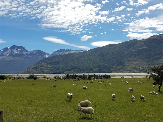 |
| 100 of the 300K sheep we saw. These just happen to have a pretty eye catching backdrop |
 |
| Oh, there were a fair bit of cows too. |
 |
| View back over Lake Wakatipu from Glenorchy |
That night saw us pulling in to another bush speckled field they call a campground next to Moke Lake. Probably the most curious thing about this place was the most trusting population of ducks you'll ever meet. The kids spent an hour watching a momma duck chase around her four chicks as they waddled in and out of campsites, on to picnic blankets, and over the kids feet. Oh, and the horses were cool too.
 |
| For all the bickering these two do, in the end, I'm pretty sure they love each other. |
 |
| Bryce and Zane befriended some baby ducks...and a family from Chile. |
Day 7 - Christmas Eve at Cascade Creek
The drive from Queenstown to Milford Sound is achingly long, especially considering it's only 40 miles away as the Kea* flies. Imagine if the only way to get to Monterrey from San Jose was to drive up the East Bay to Napa and back down thru San Francisco and then along highway 1. Then you find out the closest place to spend the night is in Half Moon Bay. (For those not from the bay area... that would be a silly way to get to Monterrey)
So we spent most of the day driving to the closest campground, Cascade Creek, before you can head down in to Milford. What an amazingly awesome site this is. The site is bordered by a moss covered beechwood forest that is eerily dense, yet at the same time, perfectly inviting. The forest floor was untouched and made me contemplate how it would have been picked bare in any California campsite. The camping areas were amongst fields of lupine and towered over by massive glacially carved walls.
This was Christmas Eve day and we were blessed with the perfect Christmas tree right next to our site. We had been toting around Christmas lights for a month and we finally had a proper tree to adorn. Our site also had a fire pit, which, of course, needed to be put to use. After an hour of desperate fire coddling, we finally gave up. The wood from the forest simply doesn't burn. It's no wonder it's so pristine in there....
 |
| Nicole whipped up a delicious breaded chicken picatta with all the fixens. Impressive what she can pull off with such meager provisions. |
 |
| Christmas Eve dinner |
 |
| Putting up the Christmas lights. |
 |
| We brought along the volleyball (with a pump) from Capetown for just this occasion. |
 |
| Settling down for the night. |
Day 8 - Christmas on Milford Sound
As we settled down for a long summer's nap the weather was becoming unsettled. Santa had managed to deliver a small gift to each of the kids with the help of The Bear That's Aware. We had a date with a Milford Sound cruise ship at 10am, so the usual Christmas morning ritual of sitting around in our pajamas and playing with stuff would have to be postponed for a year.
 |
| Couldn't fit a full sized Christmas tree in our RV, so this water bottle filled with lupine took it's place. |
 |
| One more hedgehog to add to Bryce's collection. It doubles as a hand puppet. |
The weather was growing increasingly more ominous with rain starting to fall. Here we go again... Another iconic landmark going to be masked by mother nature. Little did we know that torrential downpours in the Milford area transform the mountains in to an undescribably magnificent display of waterfalls that brought chills of excitement. A tunnel at the peak of the roadway marks the official entry in to Milford Sound and exits in to a massive black rock bowl with walls reaching skyward a thousand feet on all sides. The unrelenting rain was creating waterfalls that were seemingly springing out of the rocks themselves. The sound of thousands of waterfalls completely surrounding us was deafening. Definitely an unforgettable moment.
By the time we reached sea level, we were hoping for a break in the weather. But alas, it was not meant to be. We boarded the boat completely drenched with all the views clouded over. The rain persisted, which continued to fuel the waterfalls cascading directly in to the ocean. But for the fact that we would get totally soaked if we stepped foot outside, it was still spectacular.
 |
| And there it is! Milford Sound in all it's glory. Looked a lot like Mizen Head, Table Mountain, and the Three Sisters. |
 |
| Zane and Autumn settling in for the cruise |
 |
| For all the bickering, in the end, I still think Autumn and Zane love each other. |
 |
| It was pretty incredible to see all the waterfalls cascading in to the ocean. |
After a brief stop at the Underwater Observatory (Milford Sound is uniquely configured to bring deepwater sea life nearly to the surface), the rains tapered off and the clouds parted. Yep, it's beautiful. We finally got the views we were expecting without getting drenched. The boat guides said we actually got the best of both worlds, rains for the waterfalls, and sun for the views. Come mid afternoon, as we drove back out of the valley, the landscape had transformed yet again as the waterfalls ran out of food. The sun was now shimmering off the damp rock walls.
 |
| It was impressive. And to think a massive glacier once carved this magnificent ocean filled valley. |
 |
| The same spot after the tunnel after the storm had passed. |
 |
| Christmas Filet Mignon dinner. Yummy |
 |
We closed out this wonderful Christmas Day with an exclusive showing of "Elf" on Nicole's tablet.
|
Day 9 - to Dunedin
This was another travel day. Not too much to report as we drove thru mostly rolling plains and farmland. It was curious that they have the "Presidential Highway" that runs between two towns named Gore and Clinton. We should look that up some day.
Dunedin is a cool old coastal town with a beautiful Castle-like train station. This place could have been scooped out of the UK coastline and plopped right there for how similar it felt. We toyed around with staying near a blustery beach, but opted instead to free camp in the parking lot of the train station, which did not meet with Nicole's idylic vision of freedom camping. A storm passed thru and dropped a vibrant rainbow right over our mobile accommodation.
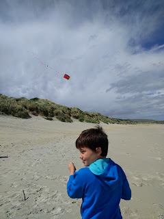 |
| Zane putting his Christmas gift to use, a kite. |
 |
| Very intricate mosaic floor in the train lobby. |
 |
| Decent wall art in town |
 |
| Turns out that Autumn is at the end of a rainbow. |
Day 10 (Dec 27) - Cadbury, a hill, Boulders, and Steampunk
Dunedin is the home of a Cadbury Chocolate Factory that provides a tour. So yeah, we did that. Autumn was positively giddy. The best part... They give you a bag at the beginning of the tour, and for no particular reason, every ten minutes, the guide simply doles out candy to everyone. So it's like Halloween wrapped up in a chocolate making tour. Sadly, the factory is slated to close next year as it's the runt of the bunch, but the tour shall live on.
About a two minutes detour out of Dunedin on our way back North is Baldwin St, the steepest street in the world at 35 degrees. Look it up. It appears to be true. Being from San Francisco and Berkeley, we had to check the veracity of this bold claim. Yep, it's pretty darn steep. It also, along with Lombard St, appears to be the worst street in the world to live on with hordes of tourists inching their way up and down it, bent over and panting in the middle of the road every 50ft.
 |
| It's pretty darn steep |
Another couple hours up the highway from Dunedin is the Moeraki Boulders, a curious collection of large round boulders haphazardly scattered on a beautiful dark sand beach. A handful of them have been split open by some mystical force as though they were dropped from the sky. I must say, New Zealand definitely takes the lead in creating some head scratching natural wonders.
 |
| Wonder how many more of these boulder balls are buried under the hillside. |
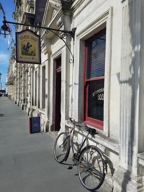
One more hour up the road is another funky and absolutely beautiful little coastal town called Oamaru. It's claim to fame is the Steampunk culture blended in to a Victorian town. It also has a great park for the kids with the longest free zipline we have found so far.
We were desperate for some WiFi that night to finalize some arrangements, but hadn't planned on a holiday park. So we did the next best thing... We found the local Timaru library (which by that time had closed), parked in the empty lot, tapped in to the free signal, and made burritos. The flexibility of an RV can be quite liberating.
 |
| The sign on the Library says it's a free wifi zone. Yes, yes it is. |
Day 11 (Dec 28) - Back to Christchurch
We had an early flight the following morning, so our final day was entirely uneventful as we headed back in to Christchurch to return the RV.
 |
| Our final meal required finishing off every last drop of the Hidden Valley Ranch that my parents brought. The only way to do so... open bottle surgery |
So what would we do differently, and why...
It's a "big" country about the size of California with plenty to see and not a lot of people and towns to get in your way (which is good and bad). It's a bit light on accommodations which sort of forces your hand on jumping from one holiday park (fancy campsites) to the next... Unless you spring for a "Self Contained" vehicle which simply means it has a loo and collects waste on board. This means you can "freedom camp" - spending the night at nearly any roadside picnic area or random side road you like (which is curiously harder to do than you would think). How cool is it that New Zealand actually has national laws in place that allows people to move about so freely.
This is the official logo certifying your ability to relieve yourself on wheels...
We did a ton of research before boarding our land yacht, and everything pointed to cruising around in an RV and making sure the West Coast drive was on the itinerary. Here's what we discovered that would change how we would do it again.
Firstly, our "self contained" lifespan was about 48 hours, forcing us to seek out RV park accommodations every third day to recharge our lives, drop our waste, and clean up. These overnight stays were nearly the cost of just getting a standard accommodation. We already unloaded a small fortune on renting a mobile home, so it all seemed like a double up. Admittedly, the flexibility to pull over anywhere we wanted afforded us a couple of nights in places we would otherwise have missed, but I think we could have managed with a day shot here or there.
Imagine navigating this loop and you'll get a sense of the overall distance we covered. San Francisco -> Shasta -> Lassen -> Tahoe -> Yosemite (via 395) -> Kings Canyon and back to Yosemite -> Los Angeles (via Bishop) -> Santa Barbara (via 101) -> Monterey -> Half Moon Bay -> San Francisco. (Mental note - That would make for an epic trip). It's a long way, and the RV is slow, loud, and surprisingly hard to take in the scenery (except for the driver and shotgun).
Taking all this in consideration, I think we would have opted for a decent sized SUV, or Minivan, and stayed in the numerous holiday parks scattered about this vast island. Note, if just Nicole and I, we would have definitely rented the smaller self-contained vans (but not those gaudy green and purple Jucy things).
As for the itinerary... Most folks recommend a drive along the West Coast to take in the glaciers, and towering mountains that crash in to the sea. Beautiful to be sure, but boy it's a long way and pulled us away from what we really enjoyed, being in nature down near Queenstown and Milford Sound. Coming in and out of Christchurch also added several long days of driving.
Putting all this in consideration, if we had to do it all over again, we would have based ourselves in Queenstown (reminiscent of South Lake Tahoe), and took overnight jaunts to the sites in the area. We were also quite enamored with the North Island and felt like we did not give it enough time.
A couple random comments
- Whereas the North Island names of towns were largely Polynesian sounding double words like Poonuinui or Wypoowypoo, the towns and sites of the South Island sounded like they were straight out of a John Wayne flic with names like Blackball, Greymouth, Stillwater, Strongman, Outram, Gore, Arrowtown, and Roaring Swine Creek. It felt like we were driving around the Old West expecting to come across a wagon train navigating around pastures of grazing sheep.
- We (and by we, I mean Zane and Bryce) had our fair share of nosebleeds due to the wonderfully dry air (in between periodic rain storms).
- Our RV was tired. Not a state of being where it had tires. It was worn out and ready for extreme RV makeover. Probably our greatest disappointment was the lack of ability to connect our phone (with all our music) to the stereo. I mean come on... How can you be expected to take a 2,200km road trip without tunes?
 |
| Put my portable blue tooth speaker to work. Although it wasn't meant to drown out all that RV road noise. |
- Everyone kept saying that the holidays are the busiest time of the year and to make sure we booked well in advance. For being the busiest time of the year, it sure seemed pretty mellow to us. Campsites were maybe half full, and the holiday parks were easy to book.
* A Kea is the only parrot in the world that lives in an Alpine region and is only found in a handful of places in New Zealand. It's a beautiful big green bird and one of the smartest birds on the planet.


